Your Bag is Empty




Old Folding Maps specialise in supplying original maps and reproductions of rarer antique maps - all dissected, laid onto 100% natural linen cloth and supplied in unique hand-made matching slip cases. This is a very special gift for a map-lover.
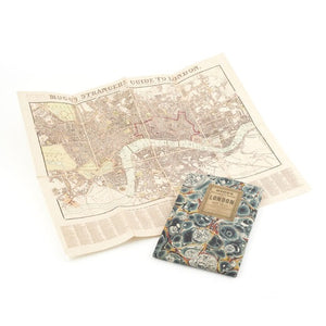
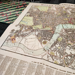
Taken from the original antique copper engraved map or plan first published in 1806 by Edward Mogg. The map was continually updated and this edition was published in 1837. Extending from Hyde Park in the west to the Mile End Road in the East and from Pentonville in the north to Kennington in the South. At the bottom of the map is "A list of 500 of the principal places with references to their situation in the above plan".
20 x 24inches (Old Folding Map watermark does not appear on actual reproduced maps)
We offer free standard UK delivery on all orders over £50.
Orders up to £30 are charged a flat fee of £4.95 within the UK.
Orders between £30.01 and £50 are charged a flat fee of £6.95 within the UK.
Usual UK delivery timescale (excluding custom prints) is between 5 and 7 working days from the date of dispatch.
Due to the EU Regulation 2023/988 (GPSR) selected items are not available for delivery to Northern Ireland.
Delivery Worldwide
Due to the EU Regulation 2023/988 (GPSR) we are currently unable to accept any orders for delivery to EU member countries and Switzerland.
We can deliver to other selected countries worldwide.
Returns & refunds
If you are not completely satisfied with your item you may return it within 28 days for a refund.
Due to the EU Regulation 2023/988 (GPSR) we are unable to deliver this item to Northern Ireland. We apologise for any inconvenience caused.
Made In: United Kingdom
SKU: Library003
Old Folding Maps specialise in supplying original maps and reproductions of rarer antique maps - all dissected, laid onto 100% natural linen cloth and supplied in unique hand-made matching slip cases. This is a very special gift for a map-lover.
Taken from the original antique copper engraved map or plan first published in 1806 by Edward Mogg. The map was continually updated and this edition was published in 1837. Extending from Hyde Park in the west to the Mile End Road in the East and from Pentonville in the north to Kennington in the South. At the bottom of the map is "A list of 500 of the principal places with references to their situation in the above plan".
20 x 24inches (Old Folding Map watermark does not appear on actual reproduced maps)
We offer free standard UK delivery on all orders over £50.
Orders up to £30 are charged a flat fee of £4.95 within the UK.
Orders between £30.01 and £50 are charged a flat fee of £6.95 within the UK.
Usual UK delivery timescale (excluding custom prints) is between 5 and 7 working days from the date of dispatch.
Due to the EU Regulation 2023/988 (GPSR) selected items are not available for delivery to Northern Ireland.
Delivery Worldwide
Due to the EU Regulation 2023/988 (GPSR) we are currently unable to accept any orders for delivery to EU member countries and Switzerland.
We can deliver to other selected countries worldwide.
Returns & refunds
If you are not completely satisfied with your item you may return it within 28 days for a refund.
Due to the EU Regulation 2023/988 (GPSR) we are unable to deliver this item to Northern Ireland. We apologise for any inconvenience caused.


